Topic: Maps to GIS shape Subscribe | Previous | Next
Hi!
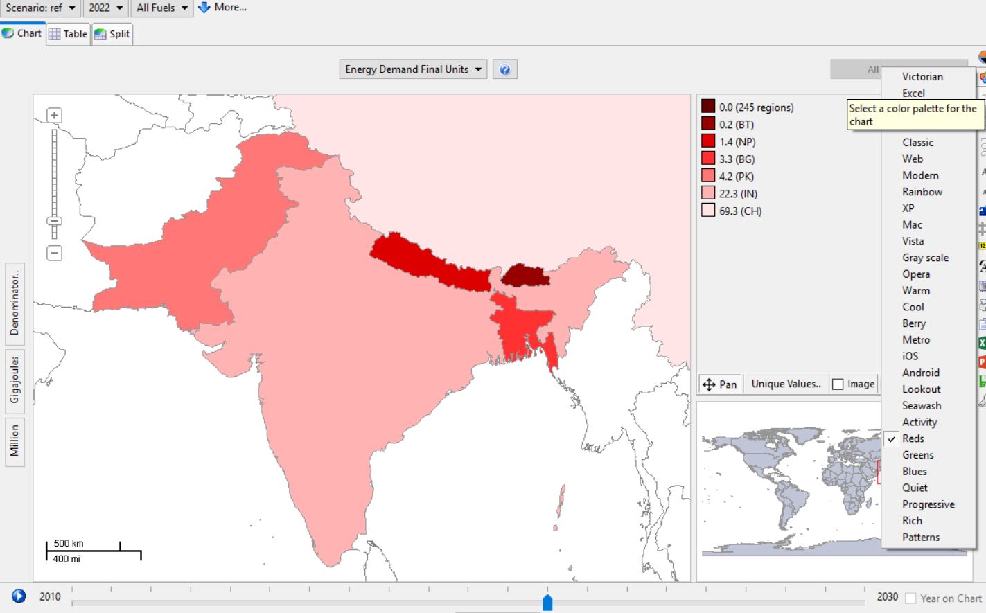
.png)


Hi Jimmy,
Thanks,

Hi Wulf - sorry about this. We can reproduce the problem, and we're looking into it carefully now.
Thank you Taylor!
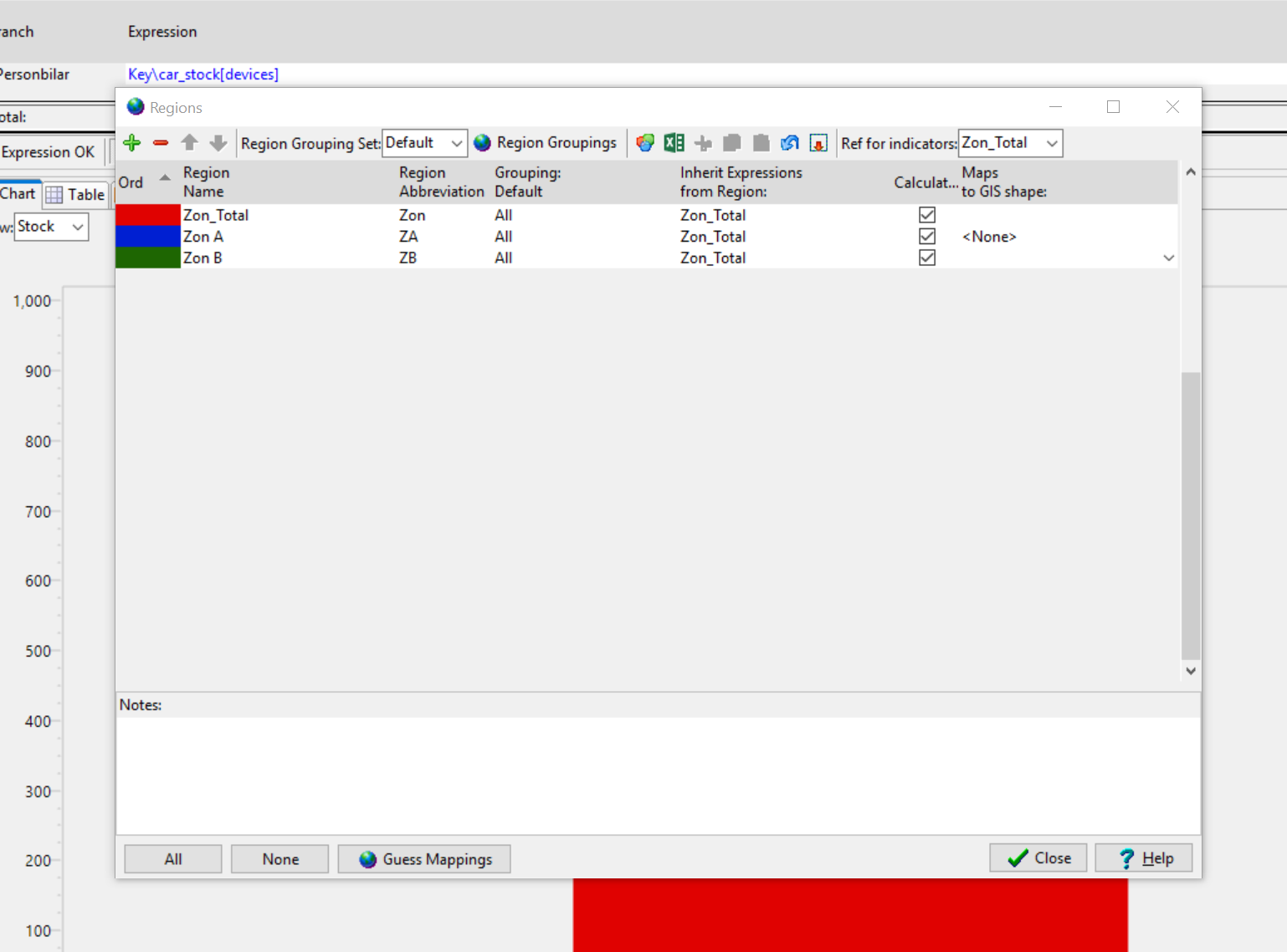
We currently have a Masterstudent who is developing an energy planning for her home country. She does a resource and demand assessment in ArcGIS but also wants to use LEAP as a planning tool and I remembered the map option in LEAP, although I have never used it before. I might have some questions on the regions option later on, in particular how you can simulate imports and exports of the same fuel in one region. Example: You have a lot of hydro generation in region 1 and can export to region 2 in the rainy season, but you need fossil generation from region 2 during the dry season. It is difficult to define the export/import shares beforehand. I have a few ideas how this could work but haven't tried it yet. If you, or anybody else in the community, have any suggestions that would be great.
color:#1F497D;mso-fareast-language:EN-US">Dear Taylor
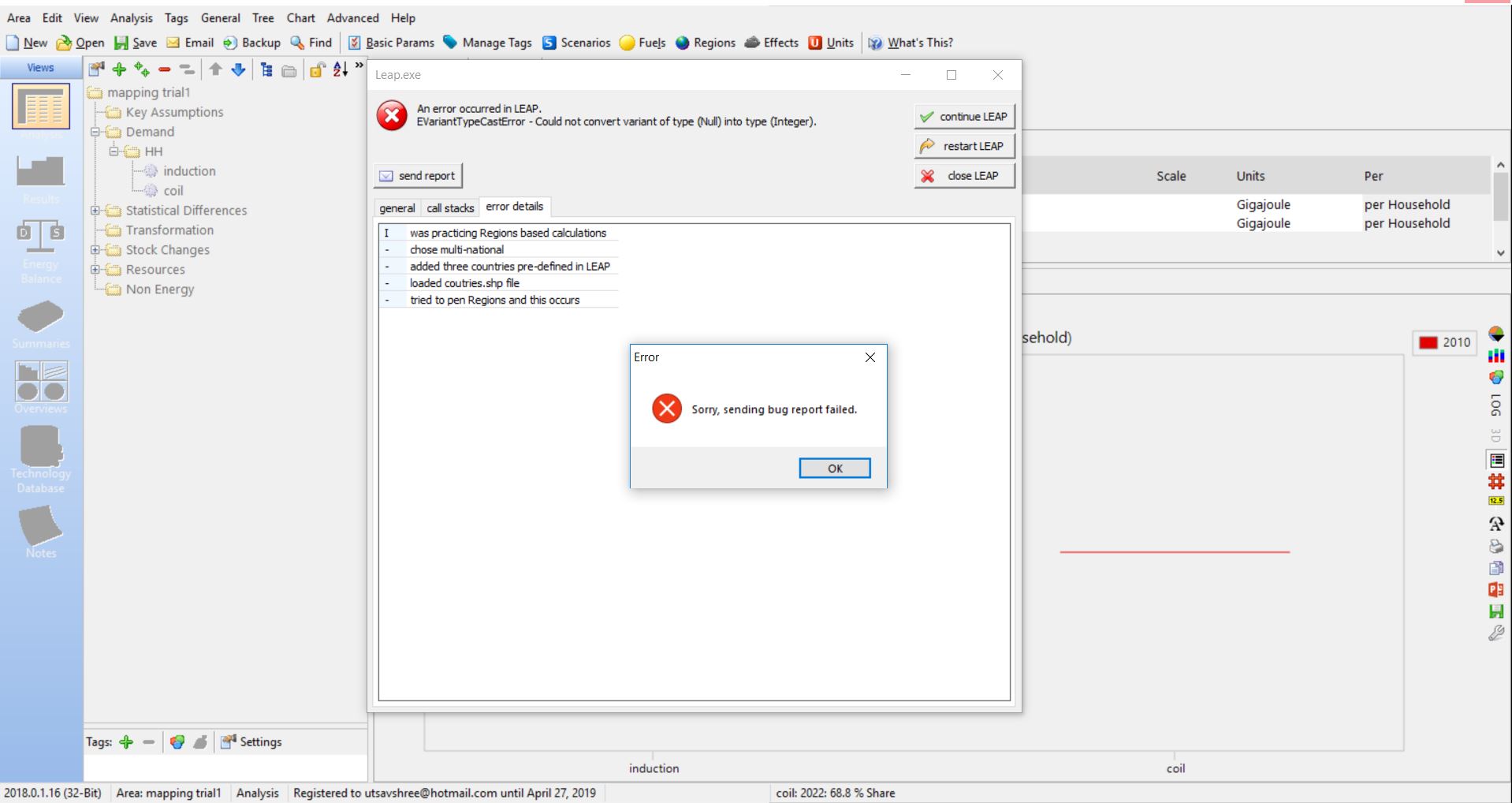
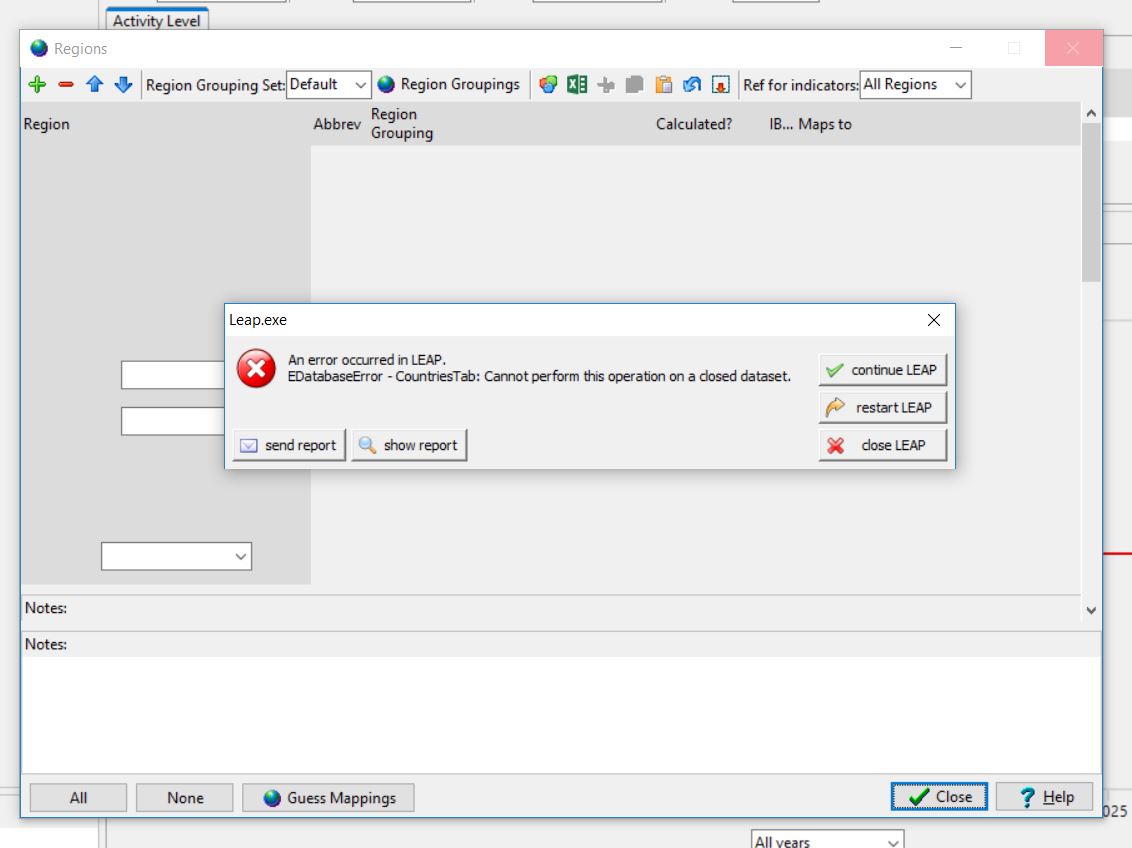
color:#1F497D;mso-fareast-language:EN-US">After the last LEAP update I am now
color:#1F497D;mso-fareast-language:EN-US">
color:#1F497D;mso-fareast-language:EN-US"> able to load the maps in the regions window but I get an error message when I
color:#1F497D;mso-fareast-language:EN-US">
color:#1F497D;mso-fareast-language:EN-US">want to see results in the maps view (Field
color:#1F497D;mso-fareast-language:EN-US">
mso-fareast-font-family:Calibri;mso-fareast-theme-font:minor-latin;color:#1F497D;
mso-ansi-language:EN-GB;mso-fareast-language:EN-US;mso-bidi-language:AR-SA">LEAP_V000 not found). Can you
help?
color:#1F497D;mso-fareast-language:EN-US">Regards
color:#1F497D;mso-fareast-language:EN-US">
Wulf

Hi Wulf,
Thanks,
Hi Wulf,


1 Like Hi Utsav,
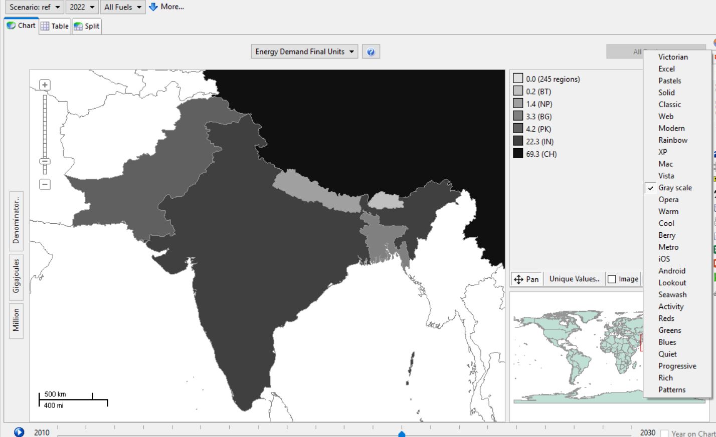
Great suggestions! i havent really spent any time optimizing the palettes for maps yet, but will investigate flipping them around for next release.